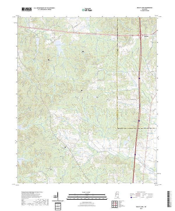
2024 Map of Bailey Lake
USGS Topo · Published 2024About this map
Winona serves as a primary reference point in this central Mississippi landscape, situated along the eastern edge of a region defined by numerous named creeks and family cemeteries. The terrain is crisscrossed by an extensive network of rural routes such as Barrentine Rd and McCarley Rd, which link scattered burial grounds like Marvin Cem and Nebo Cem to the surrounding homesteads. Water is a defining element of the local geography, with drainage systems like Powells Creek and Caney Creek feeding into smaller catchments such as Booths Lake and Spring Lake. These features, along with the Carroll Co Montgomery Co boundary, illustrate the intersection of natural topography and administrative borders in this part of the state. Genealogists may find value in the specific placement of rural landmarks like Summerfield Cem and New Salem Cem, which remain anchored in the landscape near Hurricane Creek.
Find a feature on this map
54 named features on this map. Tap any name to fly to it.
Don’t see what you’re looking for? This feature index may not catch every label — zoom into the map to look around manually.
Map Details
Editions of this 2024 Bailey Lake Map
This is the sole edition of this map. No revisions or reprints were ever made.
Other maps of this area

1953 · West Point
USGS Topo · 1:250,000

1954 · Duck Hill
USGS Topo · 1:62,500

1954 · McCarley
USGS Topo · 1:62,500

1958 · West Point
USGS Topo · 1:250,000

1963 · West Point
USGS Topo · 1:250,000

1966 · Winona
USGS Topo · 1:24,000
1966 · Vaiden
USGS Topo · 1:24,000

1968 · Winona
USGS Topo · 1:62,500
1975 · Peachahala Creek
USGS Topo · 1:24,000
1975 · Murdock Lake
USGS Topo · 1:24,000