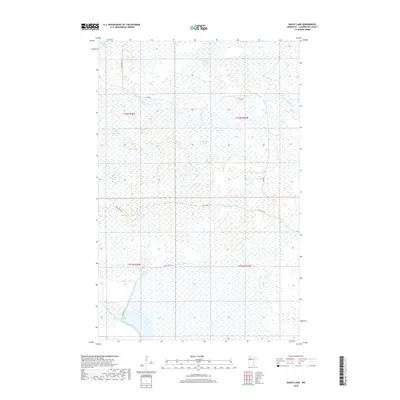
2019 Map of Bailey Lake
USGS Topo · Published 2019About this map
The Red Lake River meanders across this northern landscape, defining the hydrology of a region dominated by extensive wetlands and seasonal water bodies. This 2019 survey captures the wilderness character of Clearwater County, where the Clearwater River cuts through the southwestern corner, separate from the primary drainage of the Red Lake River. The area is sparsely populated with few permanent structures, instead featuring a network of reservation roads such as Resvn Hwy 21 and Resvn Hwy 22 that navigate the marshy terrain. Small, isolated bodies of water like Bailey Lake and Smith Lake are primary landmarks in this low-lying territory, which remains largely defined by its natural watercourses and the seasonal ebb and flow of its massive wetland complexes.
Find a feature on this map
12 named features on this map. Tap any name to fly to it.
Don’t see what you’re looking for? This feature index may not catch every label — zoom into the map to look around manually.
Map Details
Editions of this 2019 Bailey Lake Map
This is the sole edition of this map. No revisions or reprints were ever made.
Other maps of this area

1918 · Jelle
USGS Topo · 1:62,500

1919 · Churnes
USGS Topo · 1:62,500

1919 · Winsor
USGS Topo · 1:62,500

1954 · Bemidji
USGS Topo · 1:250,000

1954 · Roseau
USGS Topo · 1:250,000

1957 · Roseau
USGS Topo · 1:250,000

1957 · Bemidji
USGS Topo · 1:250,000

1958 · Bemidji
USGS Topo · 1:250,000

1958 · Roseau
USGS Topo · 1:250,000
1972 · Berner NE
USGS Topo · 1:24,000