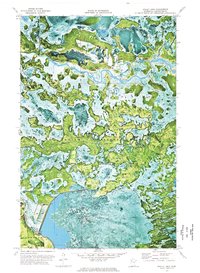
1972 Map of Bailey Lake
USGS Topo · Published 1976About this map
The Red Lake Indian Reservation dominates this 1970s orthophotomap, showing a complex aquatic landscape in Clearwater County. Unlike traditional topographic sheets, this aerial-based survey provides a visual record of the wetlands and forests, where the Red Lake River meanders through a labyrinth of islands and channels. The terrain includes a concentration of lakes in the north, including Bailey Lake, Smith Lake, and Roosevelt Lake, which define the upper drainage patterns. Near the southern boundary of the reservation, evidence of land use appears at the Rice Field and a series of Gravel Pits. The presence of the Hangaard township area in the southwest corner provides a transition from the wild river bottoms to more structured surveying lines. This map is particularly valuable for its depiction of the shifting water levels and vegetation within the reservation during the early 1970s.
Find a feature on this map
10 named features on this map. Tap any name to fly to it.
Don’t see what you’re looking for? This feature index may not catch every label — zoom into the map to look around manually.
Map Details
Editions of this 1972 Bailey Lake Map
This is the sole edition of this map. No revisions or reprints were ever made.
Other maps of this area

1918 · Jelle
USGS Topo · 1:62,500

1919 · Churnes
USGS Topo · 1:62,500

1919 · Winsor
USGS Topo · 1:62,500

1954 · Bemidji
USGS Topo · 1:250,000

1954 · Roseau
USGS Topo · 1:250,000

1957 · Roseau
USGS Topo · 1:250,000

1957 · Bemidji
USGS Topo · 1:250,000

1958 · Bemidji
USGS Topo · 1:250,000

1958 · Roseau
USGS Topo · 1:250,000
1972 · Berner NE
USGS Topo · 1:24,000