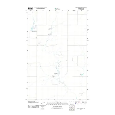
2011 Map of Bailey Reservoir
USGS Topo · Published 2011About this map
The agricultural landscape of Hill County is defined by its water management and sparse road network, centered on the Sage Creek drainage system. Numerous small-scale engineering projects illustrate the area's dependence on seasonal runoff, including the Hilldale Colony Dam and the Dees Brothers Dam. These features, often named for local ranching families or communities, indicate the dispersed nature of settlement in this part of Montana. The western edge of this survey is anchored by Bailey Reservoir, held by the Bailey-Dees-Frey Dam, while the eastern reaches include the Kiemle Reservoir. Notable terrain features like Halfway Coulee break the prairie, and the path of S Kremlin Rd provides one of the few primary transit corridors through the expansive ranch lands. This survey offers a clear view of the water infrastructure necessary to support life and industry on the northern plains.
Find a feature on this map
10 named features on this map. Tap any name to fly to it.
Don’t see what you’re looking for? This feature index may not catch every label — zoom into the map to look around manually.
Map Details
Editions of this 2011 Bailey Reservoir Map
This is the sole edition of this map. No revisions or reprints were ever made.
Other maps of this area

1904 · Assinniboine
USGS Topo · 1:62,500

1904 · Boxelder
USGS Topo · 1:62,500

1906 · Kremlin
USGS Topo · 1:62,500

1906 · Boxelder
USGS Topo · 1:62,500

1912 · Thibedeau Lake
USGS Topo · 1:125,000

1919 · Big Sandy
USGS Topo · 1:125,000

1920 · Gildford
USGS Topo · 1:125,000

1943 · Gildford
USGS Topo · 1:125,000

1953 · Havre
USGS Topo · 1:250,000

1954 · Shelby
USGS Topo · 1:250,000