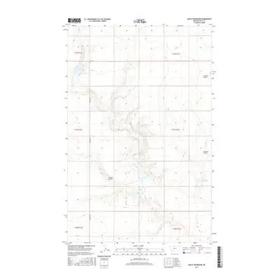
2017 Map of Bailey Reservoir
USGS Topo · Published 2017About this map
Sage Creek and its tributary, Sage Cr, carve a complex network of drainage across this portion of Hill County, defining a landscape marked by steep coulees and vital water catchments. The terrain is notably dissected by landforms such as Antelope Coulee in the northeast and Schwartz Coulee to the east, illustrating the erosional patterns typical of the Montana plains. Bailey Reservoir and Kiemle Reservoir serve as significant landmarks, anchoring the local hydrology in an area where water management is central to the land's utility. A sparse grid of rural thoroughfares, including S Kremlin Rd, provides the primary access through these townships, following the section lines of the Public Land Survey System. The map captures the quiet, functional character of the High Line region, where the interplay between dry coulees like Halfway Coulee and man-made reservoirs supports the area's agricultural and ranching foundations.
Find a feature on this map
16 named features on this map. Tap any name to fly to it.
Don’t see what you’re looking for? This feature index may not catch every label — zoom into the map to look around manually.
Map Details
Editions of this 2017 Bailey Reservoir Map
This is the sole edition of this map. No revisions or reprints were ever made.
Other maps of this area

1904 · Assinniboine
USGS Topo · 1:62,500

1904 · Boxelder
USGS Topo · 1:62,500

1906 · Kremlin
USGS Topo · 1:62,500

1906 · Boxelder
USGS Topo · 1:62,500

1912 · Thibedeau Lake
USGS Topo · 1:125,000

1919 · Big Sandy
USGS Topo · 1:125,000

1920 · Gildford
USGS Topo · 1:125,000

1943 · Gildford
USGS Topo · 1:125,000

1953 · Havre
USGS Topo · 1:250,000

1954 · Shelby
USGS Topo · 1:250,000