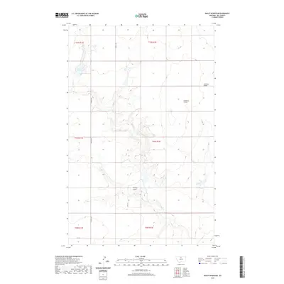
2020 Map of Bailey Reservoir
USGS Topo · Published 2020About this map
Sage Cr winds through this section of Hill County, carving a series of dramatic landforms including Antelope Coulee, Schwartz Coulee, and Halfway Coulee. This northern Montana landscape is defined by its water management systems, anchored by Bailey Reservoir in the northwest and Kiemle Reservoir to the southeast. The survey illustrates a grid-like organization of rural infrastructure, with S Kremlin Rd serving as a primary north-south artery connecting the dispersed township boundaries of T30N through T32N. The topography reveals the intricate drainage patterns that have shaped this high plains environment, where local roads like Rd 110 S and Rd 120 S follow the section lines of the Public Land Survey System, providing access to the expansive agricultural and grazing lands of the region.
Find a feature on this map
15 named features on this map. Tap any name to fly to it.
Don’t see what you’re looking for? This feature index may not catch every label — zoom into the map to look around manually.
Map Details
Editions of this 2020 Bailey Reservoir Map
This is the sole edition of this map. No revisions or reprints were ever made.
Other maps of this area

1904 · Assinniboine
USGS Topo · 1:62,500

1904 · Boxelder
USGS Topo · 1:62,500

1906 · Kremlin
USGS Topo · 1:62,500

1906 · Boxelder
USGS Topo · 1:62,500

1912 · Thibedeau Lake
USGS Topo · 1:125,000

1919 · Big Sandy
USGS Topo · 1:125,000

1920 · Gildford
USGS Topo · 1:125,000

1943 · Gildford
USGS Topo · 1:125,000

1953 · Havre
USGS Topo · 1:250,000

1954 · Shelby
USGS Topo · 1:250,000