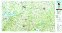
1978 Map of Bainbridge
USGS Topo · Published 1980About this map
The Flint River and Chattahoochee River converge to form the Apalachicola River at the massive reservoir of Seminole Lake, anchoring this borderland study of South Georgia and North Florida. In the late 1970s, the region was characterized by its sprawling river networks and specialized industrial sites, including the Bainbridge State Hospital and the Decatur County Industrial Air Park. The landscape shows a deep agricultural and timber history, punctuated by rural settlements like Attapulgus and Amsterdam that were tied to the Seaboard Coast Line Railroad. Conservation areas such as Torreya State Park and Killarn Gardens State Park protect the bluffs and unique ecology where the coastal plain begins to ripple into Curry Hill. Evidence of local industry is seen in a Strip Mine and the remnants of an Old Railroad Grade near the state line.
Find a feature on this map
135 named features on this map. Tap any name to fly to it.
Don’t see what you’re looking for? This feature index may not catch every label — zoom into the map to look around manually.
Map Details
Editions of this 1978 Bainbridge Map
This is the sole edition of this map. No revisions or reprints were ever made.
Other maps of this area

1940 · Tallahassee
USGS Topo · 1:62,500

1942 · Tallahassee
USGS Topo · 1:62,500

1943 · Tallahassee
USGS Topo · 1:62,500

1943 · Lake Talquin
USGS Topo · 1:62,500

1945 · Blountstown
USGS Topo · 1:31,680

1945 · Hosford
USGS Topo · 1:31,680

1945 · Bristol
USGS Topo · 1:31,680

1952 · Cypress
USGS Topo · 1:24,000

1952 · Dellwood
USGS Topo · 1:24,000

1952 · Bascom
USGS Topo · 1:24,000