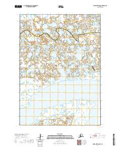
2020 Map of Baird Inlet D-8 NE
USGS Topo · Published 2020About this map
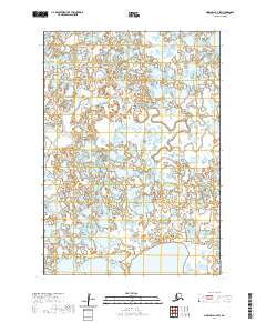
The settlement of Newtok sits at the edge of a complex water-bound landscape along the western coast of Alaska. This 2020 survey documents the village during a period of significant environmental transition, showing the close relationship between the community and the surrounding wetlands and waterways. Transport infrastructure is represented by the Newtok Airport, a critical link for this coastal area. To the north, the Kealavik River meanders through a labyrinth of small ponds and thaw lakes characteristic of the Yukon-Kuskokwim Delta. The map also delineates the administrative boundary between the Kusilvak Census Area and the Bethel Census Area, which cuts across the marshy terrain. The sparse human footprint here emphasizes the primacy of the natural hydrologic system and the importance of the few established hubs for local transit and residence.
Find a feature on this map
4 named features on this map. Tap any name to fly to it.
Don’t see what you’re looking for? This feature index may not catch every label — zoom into the map to look around manually.
Map Details
Editions of this 2020 Baird Inlet D-8 NE Map
This is the sole edition of this map. No revisions or reprints were ever made.
Other maps of this area

1951 · Marshall
USGS Topo · 1:250,000

1951 · Baird Inlet
USGS Topo · 1:250,000
1954 · Marshall A-8
USGS Topo · 1:63,360
1954 · Marshall A-7
USGS Topo · 1:63,360

1954 · Baird Inlet D-7
USGS Topo · 1:63,360

1954 · Marshall
USGS Topo · 1:250,000

1954 · Baird Inlet
USGS Topo · 1:250,000

1954 · Baird Inlet D-8
USGS Topo · 1:63,360
2020 · Marshall A-8 SE
USGS Topo · 1:25,000
2020 · Marshall A-7 SW
USGS Topo · 1:25,000