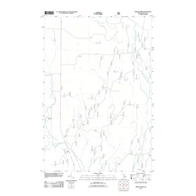
2011 Map of Baker Creek
USGS Topo · Published 2011About this map
Rapid River and the Whitefish River system define the drainage of this central Upper Peninsula landscape, where a network of forest roads and township routes provides access to the dense woodlands of Delta County. The Dutch Mill Cemetery serves as a quiet landmark for local genealogists, situated near the western edge of the sheet along the river's path. Further downstream, the Rapid River Falls marks a significant hydrological feature in an area dominated by numerous tributaries including Baker Creek, Ferguson Creek, and Chippeny Creek.
Find a feature on this map
21 named features on this map. Tap any name to fly to it.
Don’t see what you’re looking for? This feature index may not catch every label — zoom into the map to look around manually.
Map Details
Editions of this 2011 Baker Creek Map
This is the sole edition of this map. No revisions or reprints were ever made.
Other maps of this area

1932 · Gladstone NE
USGS Topo · 1:31,680

1932 · Rapid River NE
USGS Topo · 1:31,680

1932 · Trenary SW
USGS Topo · 1:31,680

1932 · Rock NE
USGS Topo · 1:31,680

1932 · Rapid River NW
USGS Topo · 1:31,680

1932 · Trenary SE
USGS Topo · 1:31,680

1932 · Rock SE
USGS Topo · 1:31,680

1954 · Escanaba
USGS Topo · 1:250,000

1957 · Escanaba
USGS Topo · 1:250,000

1958 · Escanaba
USGS Topo · 1:250,000