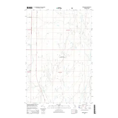
2014 Map of Baker Creek
USGS Topo · Published 2014About this map
The Hiawatha National Forest dominates this landscape in Michigan's Upper Peninsula, where a dense network of waterways defines the local geography. The confluence of the West Branch Whitefish River and the Whitefish River occurs in the southeast, while the Rapid River winds through the western sections. This territory is characterized by its complex drainage systems, including Chippeny Cr, Baker Cr, and the smaller Ferguson Cr. Evidence of early local settlement and community history appears at the Dutch Mill Cem, located near the intersection of US Hwy 41 and N River Rd. The presence of the Rapid River Falls indicates a shift in elevation that once influenced both the natural ecology and the transport routes utilized by early inhabitants of the region.
Find a feature on this map
23 named features on this map. Tap any name to fly to it.
Don’t see what you’re looking for? This feature index may not catch every label — zoom into the map to look around manually.
Map Details
Editions of this 2014 Baker Creek Map
This is the sole edition of this map. No revisions or reprints were ever made.
Other maps of this area

1932 · Gladstone NE
USGS Topo · 1:31,680

1932 · Rapid River NE
USGS Topo · 1:31,680

1932 · Trenary SW
USGS Topo · 1:31,680

1932 · Rock NE
USGS Topo · 1:31,680

1932 · Rapid River NW
USGS Topo · 1:31,680

1932 · Trenary SE
USGS Topo · 1:31,680

1932 · Rock SE
USGS Topo · 1:31,680

1954 · Escanaba
USGS Topo · 1:250,000

1957 · Escanaba
USGS Topo · 1:250,000

1958 · Escanaba
USGS Topo · 1:250,000