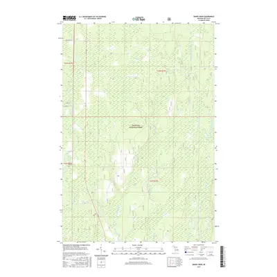
2017 Map of Baker Creek
USGS Topo · Published 2017About this map
Hiawatha National Forest dominates this portion of the Upper Peninsula, where a dense network of watercourses defines the landscape north of Lake Michigan. The drainage basin is anchored by the Whitefish River and its West Branch, which parallel the Rapid River to the west. These waterways, along with smaller tributaries like Baker Creek, Chippeny Cr, and Ferguson Cr, historically supported the region's timber and transport needs. The presence of the Mill Cem suggests a settled past tied to early industry, while landmarks such as Rapid River Falls highlight the natural drops in elevation across the township. Glacial legacy is evident in the scattered water bodies, including Mud Lake, Merles Lake, and Spring Lake, which are tucked between the forest sections of the t43n r21w and t42n r21w townships.
Find a feature on this map
22 named features on this map. Tap any name to fly to it.
Don’t see what you’re looking for? This feature index may not catch every label — zoom into the map to look around manually.
Map Details
Editions of this 2017 Baker Creek Map
This is the sole edition of this map. No revisions or reprints were ever made.
Other maps of this area

1932 · Gladstone NE
USGS Topo · 1:31,680

1932 · Rapid River NE
USGS Topo · 1:31,680

1932 · Trenary SW
USGS Topo · 1:31,680

1932 · Rock NE
USGS Topo · 1:31,680

1932 · Rapid River NW
USGS Topo · 1:31,680

1932 · Trenary SE
USGS Topo · 1:31,680

1932 · Rock SE
USGS Topo · 1:31,680

1954 · Escanaba
USGS Topo · 1:250,000

1957 · Escanaba
USGS Topo · 1:250,000

1958 · Escanaba
USGS Topo · 1:250,000