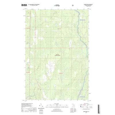
2019 Map of Baker Creek
USGS Topo · Published 2019About this map
The Hiawatha National Forest dominates this Delta County landscape, where the waters of the Whitefish Wild and Scenic River and the Rapid River converge toward the north of Lake Michigan. This 2019 survey illustrates a region defined by its hydrology, showing the intricate drainage of Baker Cr, Ferguson Cr, and Chippeny Cr. The presence of the Dutch Mill Cem near the banks of the Rapid River provides a specific point of interest for genealogists tracing local families in Masonville Township.
Find a feature on this map
24 named features on this map. Tap any name to fly to it.
Don’t see what you’re looking for? This feature index may not catch every label — zoom into the map to look around manually.
Map Details
Editions of this 2019 Baker Creek Map
This is the sole edition of this map. No revisions or reprints were ever made.
Other maps of this area

1932 · Gladstone NE
USGS Topo · 1:31,680

1932 · Rapid River NE
USGS Topo · 1:31,680

1932 · Trenary SW
USGS Topo · 1:31,680

1932 · Rock NE
USGS Topo · 1:31,680

1932 · Rapid River NW
USGS Topo · 1:31,680

1932 · Trenary SE
USGS Topo · 1:31,680

1932 · Rock SE
USGS Topo · 1:31,680

1954 · Escanaba
USGS Topo · 1:250,000

1957 · Escanaba
USGS Topo · 1:250,000

1958 · Escanaba
USGS Topo · 1:250,000