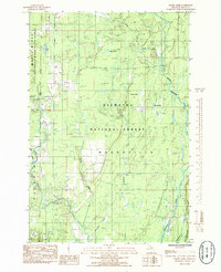
1985 Map of Baker Creek
USGS Topo · Published 1985About this map
The confluence of the Whitefish River and the West Branch Whitefish River dominates this mid-1980s terrain in Delta County. The landscape is a patchwork of public lands, defined by the boundaries of the Escanaba River State Forest to the west and the expansive Hiawatha National Forest covering much of the central and eastern sections. This provisional survey captures the area within the civil township of Masonville during a period of recreational and industrial use, noting a dedicated Ski Trail in the southern forest and a Gravel Pit near the riverbanks.
Find a feature on this map
20 named features on this map. Tap any name to fly to it.
Don’t see what you’re looking for? This feature index may not catch every label — zoom into the map to look around manually.
Map Details
Editions of this 1985 Baker Creek Map
This is the sole edition of this map. No revisions or reprints were ever made.
Other maps of this area

1932 · Gladstone NE
USGS Topo · 1:31,680

1932 · Rapid River NE
USGS Topo · 1:31,680

1932 · Trenary SW
USGS Topo · 1:31,680

1932 · Rock NE
USGS Topo · 1:31,680

1932 · Rapid River NW
USGS Topo · 1:31,680

1932 · Trenary SE
USGS Topo · 1:31,680

1932 · Rock SE
USGS Topo · 1:31,680

1954 · Escanaba
USGS Topo · 1:250,000

1957 · Escanaba
USGS Topo · 1:250,000

1958 · Escanaba
USGS Topo · 1:250,000