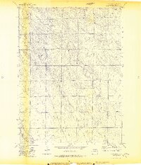
1972 Map of Baker Draw
USGS Topo · Published 1974About this map
Baker Draw and its complex network of ephemeral drainages characterize this high plains landscape in Weld County. Recorded during the early 1970s, the map highlights the critical importance of water management in this arid region, featuring several unnamed watercourses alongside Howard Creek and Little Sand Creek. The presence of Sand Res No 1 and scattered well sites points to the ranching and agricultural foundations of the area, where land use was heavily dependent on capturing seasonal runoff. Industrial development is marked by a prominent Pipeline cutting across the terrain, reflecting the energy infrastructure expanding through the Colorado plains during this period. The survey's detailed contour lines reveal the subtle, eroding breaks and draws that define the local topography between more established creek beds like Sand Creek.
Find a feature on this map
8 named features on this map. Tap any name to fly to it.
Don’t see what you’re looking for? This feature index may not catch every label — zoom into the map to look around manually.
Map Details
Editions of this 1972 Baker Draw Map
2 editions found
Other maps of this area

1908 · Eaton
USGS Topo · 1:125,000

1910 · Eaton
USGS Topo · 1:125,000

1954 · Greeley
USGS Topo · 1:250,000

1957 · Greeley
USGS Topo · 1:250,000

1958 · Greeley
USGS Topo · 1:250,000

1960 · Purcell
USGS Topo · 1:24,000
1960 · Galeton
USGS Topo · 1:24,000

1961 · Greeley
USGS Topo · 1:250,000

1964 · Greeley
USGS Topo · 1:250,000

1965 · Greeley
USGS Topo · 1:250,000