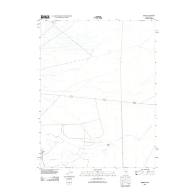
2012 Map of Baker
USGS Topo · Published 2012About this map
Baker stands as the central hub of this Great Basin landscape, where the high desert terrain meets the eastern edge of Nevada near the Utah border. The settlement is anchored by the Baker Post Office and sits at a critical juncture for local water management, evidenced by the nearby Baker Reservoir and the Sinks of Baker. These features illustrate the complex hydrology of the region, where perennial streams like Lehman Creek and Baker Creek flow from the western mountains toward terminal sinks in the valley floor. Transportation is defined by a sparse but vital network of routes including Gandy Rd and Cut Off Rd, which facilitate movement between isolated homesteads and grazing lands. The presence of Rock Canyon and Silver Creek further north highlights the varied drainage patterns that dictate life and land use in this arid environment.
Find a feature on this map
12 named features on this map. Tap any name to fly to it.
Don’t see what you’re looking for? This feature index may not catch every label — zoom into the map to look around manually.
Map Details
Editions of this 2012 Baker Map
This is the sole edition of this map. No revisions or reprints were ever made.
Other maps of this area

1908 · Fish Springs
USGS Topo · 1:250,000

1910 · Fish Springs
USGS Topo · 1:250,000

1949 · Garrison
USGS Topo · 1:62,500

1951 · Garrison
USGS Topo · 1:62,500

1953 · Richfield
USGS Topo · 1:250,000

1953 · Delta
USGS Topo · 1:250,000

1956 · Lund
USGS Topo · 1:250,000

1956 · Ely
USGS Topo · 1:250,000

1958 · Richfield
USGS Topo · 1:250,000

1958 · Delta
USGS Topo · 1:250,000