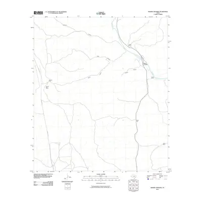
2010 Map of Bakers Crossing
USGS Topo · Published 2010About this map
The Devils River carves a path through the limestone landscape of Val Verde County, anchored by the settlement of Bakers Crossing. In 2010, this West Texas terrain was defined by large-scale ranching and the intricate drainage systems of Harland Canyon, Burnt Canyon, and Cedar Canyon. The map reveals the layout of private landholdings, including S Baker Ranch, W Baker Ranch, and the R Prosser Ranch, showing how human activity in this arid region remains tethered to water sources and traditional livestock boundaries. Transportation is centered on the corridor of Ranch Rd 1024 and the presence of the Lazy Two Ranch Airport, which highlights the necessity of air travel for reaching these distant territories. Topographic landmarks like White Gap and Hudson Canyon serve as critical navigational points across the brush-covered flats and steep-walled drainages.
Find a feature on this map
13 named features on this map. Tap any name to fly to it.
Don’t see what you’re looking for? This feature index may not catch every label — zoom into the map to look around manually.
Map Details
Editions of this 2010 Bakers Crossing Map
This is the sole edition of this map. No revisions or reprints were ever made.
Other maps of this area

1943 · Shumla
USGS Topo · 1:62,500

1944 · Baker Crossing
USGS Topo · 1:62,500

1954 · Sonora
USGS Topo · 1:250,000

1958 · Sonora
USGS Topo · 1:250,000

1958 · Del Rio
USGS Topo · 1:250,000

1964 · Del Rio
USGS Topo · 1:250,000

1970 · Sycamore Canyon
USGS Topo · 1:24,000

1970 · Blue Hills
USGS Topo · 1:24,000

1970 · Deaton Draw
USGS Topo · 1:24,000
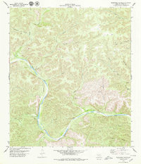
1979 · Telephone Canyon
USGS Topo · 1:24,000