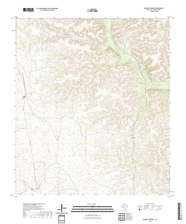
2022 Map of Bakers Crossing
USGS Topo · Published 2022About this map
The Devils River carves through the arid landscape of Val Verde County, defining the eastern edge of this topographical study. This portion of the Texas backcountry is marked by a complex system of drainage, where deep cuts like Harland Canyon, Cedar Canyon, and Burnt Canyon feed into the river valley. The presence of Huffstutler Springs suggests vital water access points in a region otherwise dominated by dry limestone breaks and scrub.
Find a feature on this map
11 named features on this map. Tap any name to fly to it.
Don’t see what you’re looking for? This feature index may not catch every label — zoom into the map to look around manually.
Map Details
Editions of this 2022 Bakers Crossing Map
This is the sole edition of this map. No revisions or reprints were ever made.
Other maps of this area

1943 · Shumla
USGS Topo · 1:62,500

1944 · Baker Crossing
USGS Topo · 1:62,500

1954 · Sonora
USGS Topo · 1:250,000

1958 · Sonora
USGS Topo · 1:250,000

1958 · Del Rio
USGS Topo · 1:250,000

1964 · Del Rio
USGS Topo · 1:250,000

1970 · Sycamore Canyon
USGS Topo · 1:24,000

1970 · Blue Hills
USGS Topo · 1:24,000

1970 · Deaton Draw
USGS Topo · 1:24,000
1979 · Telephone Canyon
USGS Topo · 1:24,000