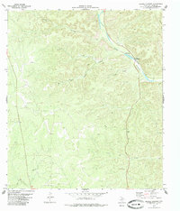
1979 Map of Bakers Crossing
USGS Topo · Published 1985About this map
The Devils River dominates this West Texas landscape, winding through a complex system of deep drainages in Val Verde County. This 1970s survey captures the area around Bakers Crossing, a significant point of passage that includes a Ford and a nearby Campground. The terrain is defined by its dramatic relief, with named features like White Gap and Harland Canyon illustrating the erosional patterns of the Edwards Plateau. A spiderweb of primitive roads and a Jeep Trail provide the only access through the backcountry, linking isolated spots such as Faro and Cedar Canyon. The map reveals a land utilized for ranching and recreation, where movement is dictated by the limestone topography and the reliable waters of the river. Geologists and local historians can trace the specific names of the many side canyons, including Hudson Canyon, Miller Canyon, and Burnt Canyon, each carving into the upland plains.
Find a feature on this map
14 named features on this map. Tap any name to fly to it.
Don’t see what you’re looking for? This feature index may not catch every label — zoom into the map to look around manually.
Map Details
Editions of this 1979 Bakers Crossing Map
This is the sole edition of this map. No revisions or reprints were ever made.
Other maps of this area

1943 · Shumla
USGS Topo · 1:62,500

1944 · Baker Crossing
USGS Topo · 1:62,500

1954 · Sonora
USGS Topo · 1:250,000

1958 · Sonora
USGS Topo · 1:250,000

1958 · Del Rio
USGS Topo · 1:250,000

1964 · Del Rio
USGS Topo · 1:250,000

1970 · Sycamore Canyon
USGS Topo · 1:24,000

1970 · Blue Hills
USGS Topo · 1:24,000

1970 · Deaton Draw
USGS Topo · 1:24,000
1979 · Telephone Canyon
USGS Topo · 1:24,000