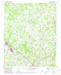
1971 Map of Bakers
USGS Topo · Published 1981About this map
Bakers sits along the Seaboard Coast Line tracks, marking a hub of rail activity in Union County during the early 1970s. The landscape is defined by the headwaters of several drainages, including Goose Creek and Stewarts Creek, which carve through a countryside dotted with rural community centers like Unionville and Bentons Crossroads. This period shows the transition of the region, where traditional landmarks like the Fairgrounds and various country churches — such as Union Grove Ch, Ebenezer Ch, and Grace Ch — persist alongside modern infrastructure like the Monroe Airport. Genealogists will find a wealth of local history in the distribution of family-named landmarks and institutions like Shiloh Sch and Watts Grove Ch. The presence of small crossroads settlements and multiple cemeteries, including the Ritch Cem, provides a detailed view of the area's settlement patterns before further suburban expansion.
Find a feature on this map
47 named features on this map. Tap any name to fly to it.
Don’t see what you’re looking for? This feature index may not catch every label — zoom into the map to look around manually.
Map Details
Editions of this 1971 Bakers Map
3 editions found
Other maps of this area

1941 · Charlotte
USGS Topo · 1:125,000

1941 · Spartanburg
USGS Topo · 1:250,000

1942 · Charlotte
USGS Topo · 1:125,000

1949 · Wilgrove
USGS Topo · 1:24,000

1949 · Midland
USGS Topo · 1:24,000

1953 · Spartanburg
USGS Topo · 1:250,000

1953 · Charlotte
USGS Topo · 1:250,000

1954 · Charlotte
USGS Topo · 1:250,000

1960 · Charlotte
USGS Topo · 1:250,000

1960 · Spartanburg
USGS Topo · 1:250,000