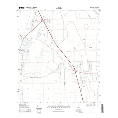
2015 Map of Bakersville
USGS Topo · Published 2015About this map
Bakersville anchors this part of St. Johns County, situated where the landscape transitions into the intricate wetlands and hammocks of the Florida coast. The area is defined by its complex hydrology, with the winding paths of Sixmile Cr and Turnbull Creek carving through the terrain. These waterways create distinct landforms like Sixmile Neck, while elevated ground provides space for named features such as Masters Island and Simone Island. The map captures a period of rapid residential and commercial expansion, evidenced by the dense network of new thoroughfares like International Golf Pky and Samara Lakes Blvd. This modern infrastructure contrasts with the older agricultural and natural patterns of the Town Br drainage, showing a community moving from rural roots toward a more suburban character in the early 21st century.
Find a feature on this map
87 named features on this map. Tap any name to fly to it.
Don’t see what you’re looking for? This feature index may not catch every label — zoom into the map to look around manually.
Map Details
Editions of this 2015 Bakersville Map
This is the sole edition of this map. No revisions or reprints were ever made.
Other maps of this area

1917 · Orange Park
USGS Topo · 1:62,500

1918 · Orange Park
USGS Topo · 1:62,500

1918 · Palm Valley
USGS Topo · 1:62,500

1937 · Bakersville
USGS Topo · 1:24,000

1937 · Elkton
USGS Topo · 1:24,000

1937 · Crescent Beach
USGS Topo · 1:24,000

1937 · St. Augustine
USGS Topo · 1:24,000

1943 · St. Augustine
USGS Topo · 1:62,500

1947 · Bostwick
USGS Topo · 1:50,000

1948 · Jacksonville
USGS Topo · 1:250,000