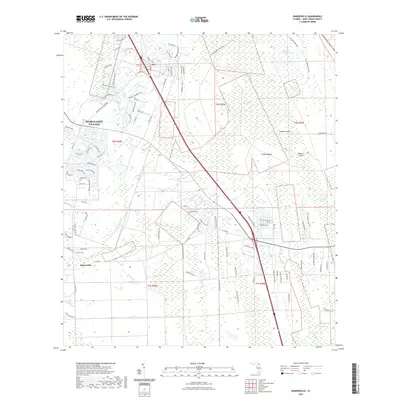
2021 Map of Bakersville
USGS Topo · Published 2021About this map
Hydrological patterns and modern development intersect in this part of Saint Johns County, where the sprawling Twelvemile Swamp dominates the central landscape. The area south of the historic crossroads of Bakersville is defined by a dense network of wetlands, including Saint Marks Pond Swamp, Fivemile Swamp, and Fourmile Swamp. These aquatic features are punctuated by slightly higher ground such as Masters Island and Simone Island, which suggest the traditional challenges of navigating and settling this low-lying Florida interior.
Find a feature on this map
102 named features on this map. Tap any name to fly to it.
Don’t see what you’re looking for? This feature index may not catch every label — zoom into the map to look around manually.
Map Details
Editions of this 2021 Bakersville Map
This is the sole edition of this map. No revisions or reprints were ever made.
Other maps of this area

1917 · Orange Park
USGS Topo · 1:62,500

1918 · Orange Park
USGS Topo · 1:62,500

1918 · Palm Valley
USGS Topo · 1:62,500

1937 · Bakersville
USGS Topo · 1:24,000

1937 · Elkton
USGS Topo · 1:24,000

1937 · Crescent Beach
USGS Topo · 1:24,000

1937 · St. Augustine
USGS Topo · 1:24,000

1943 · St. Augustine
USGS Topo · 1:62,500

1947 · Bostwick
USGS Topo · 1:50,000

1948 · Jacksonville
USGS Topo · 1:250,000