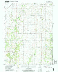
1998 Map of Bald Knob
USGS Topo · Published 2002About this map
The town of Witt sits in the northwest corner of this landscape, where the Irving railroad line cuts through the prairie toward the Montgomery and Fayette county line. The terrain is defined by the complex drainage of the East Fork and Shoal Creek, which wind through the township of Witt into Fillmore. Notable for genealogists are several rural landmarks, including the Armentrout Cemetery and the Casey Cemetery, which mark the early social footprint of these farming communities. The presence of rural institutions like Woodside Church and Bost Hill Church alongside small aviation sites like the McNeely Landing Strip reflects a transition from traditional agrarian life to modern local infrastructure. The namesake Bald Knob rises as a distinct landmark in the eastern portion of the sheet near Hurricane Creek, overlooking a network of country roads and waterway branches like Dry Fork and Lanes Branch.
Find a feature on this map
21 named features on this map. Tap any name to fly to it.
Don’t see what you’re looking for? This feature index may not catch every label — zoom into the map to look around manually.
Map Details
Editions of this 1998 Bald Knob Map
This is the sole edition of this map. No revisions or reprints were ever made.
Other maps of this area

1944 · Ramsey
USGS Topo · 1:62,500

1946 · Ramsey
USGS Topo · 1:62,500

1946 · Nokomis
USGS Topo · 1:62,500

1947 · Pana
USGS Topo · 1:62,500

1947 · Hillsboro
USGS Topo · 1:62,500

1949 · Hillsboro
USGS Topo · 1:62,500

1949 · Nokomis
USGS Topo · 1:62,500

1949 · Pana
USGS Topo · 1:62,500

1958 · Decatur
USGS Topo · 1:250,000

1961 · Decatur
USGS Topo · 1:250,000