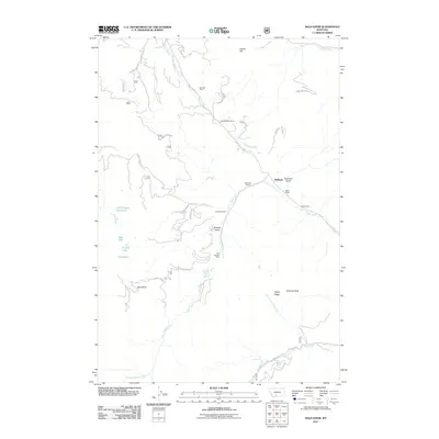
2011 Map of Bald Knob
USGS Topo · Published 2011About this map
Hoffman and several family-owned ranches sit at the center of this mountain landscape south of Livingston, where resource extraction and agriculture define the terrain. The presence of the Harrison Mine, Old Russell Mine, and Kountz Mine indicates a history of small-scale mining activity along the drainages of Trail Creek and Meadow Creek. Travel through the area is marked by established routes like Trail Creek RD and Goose Creek RD, with the Trail Creek Station serving as a notable landmark for those navigating the higher elevations near Bald Knob. The map provides clear evidence of a land shared between ranching operations, such as McReynolds Ranch and Thomae Ranch, and the complex network of mountain waterways including Bear Creek and Goose Creek.
Find a feature on this map
45 named features on this map. Tap any name to fly to it.
Don’t see what you’re looking for? This feature index may not catch every label — zoom into the map to look around manually.
Map Details
Editions of this 2011 Bald Knob Map
This is the sole edition of this map. No revisions or reprints were ever made.
Other maps of this area

1891 · Livingston
USGS Topo · 1:250,000

1893 · Livingston
USGS Topo · 1:250,000

1947 · Bozeman
USGS Topo · 1:250,000

1948 · Bozeman
USGS Topo · 1:250,000

1951 · Bozeman Pass
USGS Topo · 1:62,500

1951 · Hoppers
USGS Topo · 1:24,000

1951 · Chimney Rock
USGS Topo · 1:24,000

1955 · Bozeman
USGS Topo · 1:250,000

1955 · Emigrant
USGS Topo · 1:62,500

1955 · Fridley Peak
USGS Topo · 1:62,500