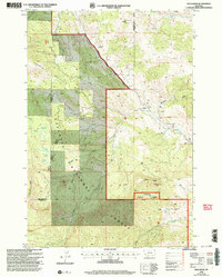
2000 Map of Bald Knob
USGS Topo · Published 2005About this map
Gallatin National Forest dominates this high-altitude landscape, where the administrative boundaries of the Bozeman District and Livingston District meet along the ridge lines of Gallatin and Park Counties. The area is defined by a legacy of resource extraction, evidenced by the scattered remains of the Harrison Mine and the Kountz Mine, as well as the Old Russell Mill. These sites are concentrated along the drainages of Meadow Creek and Hudson Creek, highlighting the importance of water access for historical industrial operations.
Find a feature on this map
30 named features on this map. Tap any name to fly to it.
Don’t see what you’re looking for? This feature index may not catch every label — zoom into the map to look around manually.
Map Details
Editions of this 2000 Bald Knob Map
This is the sole edition of this map. No revisions or reprints were ever made.
Other maps of this area

1891 · Livingston
USGS Topo · 1:250,000

1893 · Livingston
USGS Topo · 1:250,000

1947 · Bozeman
USGS Topo · 1:250,000

1948 · Bozeman
USGS Topo · 1:250,000

1951 · Bozeman Pass
USGS Topo · 1:62,500

1951 · Hoppers
USGS Topo · 1:24,000

1951 · Chimney Rock
USGS Topo · 1:24,000

1955 · Bozeman
USGS Topo · 1:250,000

1955 · Emigrant
USGS Topo · 1:62,500

1955 · Fridley Peak
USGS Topo · 1:62,500