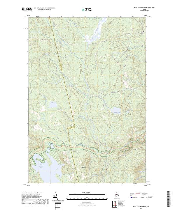
2024 Map of Bald Mountain Pond
USGS Topo · Published 2024About this map
The West Branch Piscataquis River flows through this corner of the Maine woods, where the rugged terrain is defined by the crossing of the Appalachian National Scenic Trail. The trail meanders through the southern half of the quadrangle, passing near Bald Mountain Pond and following portions of Bald Mountain Stream. This area at the border of Somerset and Piscataquis Counties is dominated by timber-access routes like Shirley Tote Rd and C C C RD, reflecting the landscape's history of logging and recreation. Near the northern edge, the presence of the Shirley Mills Cem serves as a lone marker of local genealogy and earlier settlement patterns. The network of waterways, including Little Moxie Pond and Ordway Pond, alongside natural landmarks like Hatch Falls, illustrates the drainage patterns typical of this glacial landscape.
Find a feature on this map
41 named features on this map. Tap any name to fly to it.
Don’t see what you’re looking for? This feature index may not catch every label — zoom into the map to look around manually.
Map Details
Editions of this 2024 Bald Mountain Pond Map
This is the sole edition of this map. No revisions or reprints were ever made.
Other maps of this area

1903 · Bingham
USGS Topo · 1:62,500

1905 · Bingham
USGS Topo · 1:62,500

1905 · The Forks
USGS Topo · 1:62,500

1907 · The Forks
USGS Topo · 1:62,500

1948 · Kingsbury
USGS Topo · 1:62,500

1950 · Kingsbury
USGS Topo · 1:62,500

1951 · Greenville
USGS Topo · 1:62,500

1954 · Millinocket
USGS Topo · 1:250,000

1956 · The Forks
USGS Topo · 1:62,500

1956 · Bingham
USGS Topo · 1:62,500
Featured Places
- Shirley, ME
- Blanchard Township, ME
- Bald Mountain Township, ME
- East Moxie Township, ME
- Somerset County, ME