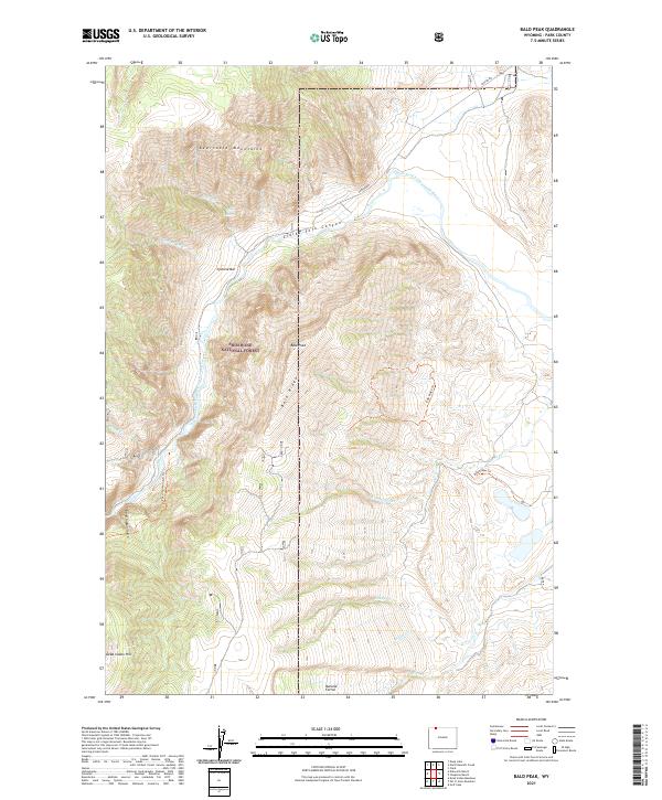
2021 Map of Bald Peak
USGS Topo · Published 2021About this map
The Shoshone National Forest landscape is dominated by the dramatic elevation changes of the Beartooth Mountains, where the Clarks Fork Wild and Scenic River carves through the massive Clarks Fork Canyon. This protected corridor features steep-walled geology including Bald Peak and the high spine of Bald Ridge, alongside historical geographic markers like Dead Indian Hill and the Natural Corral.
Find a feature on this map
28 named features on this map. Tap any name to fly to it.
Don’t see what you’re looking for? This feature index may not catch every label — zoom into the map to look around manually.
Map Details
Editions of this 2021 Bald Peak Map
This is the sole edition of this map. No revisions or reprints were ever made.
Other maps of this area

1949 · Pat O'Hara Mountain
USGS Topo · 1:62,500

1949 · Cody
USGS Topo · 1:62,500

1950 · Clark
USGS Topo · 1:62,500

1950 · Deep Lake
USGS Topo · 1:62,500

1951 · Cody
USGS Topo · 1:62,500

1955 · Cody
USGS Topo · 1:250,000

1958 · Cody
USGS Topo · 1:250,000

1962 · Cody
USGS Topo · 1:250,000

1980 · Cody
USGS Topo · 1:100,000
1987 · Dead Indian Meadows
USGS Topo · 1:24,000