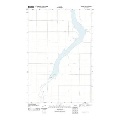
2011 Map of Baldhill Dam
USGS Topo · Published 2011About this map
Baldhill Dam controls the southern reach of Lake Ashtabula in this section of Barnes County, where the reservoir fills the winding valley of the Sheyenne River. The map highlights a rural landscape organized by a strict grid of section roads, including 21st St SE and 117th Ave SE, which provide access to the waterfront. Recreational and residential access points along the eastern shore are noted at Katie Olson Lndg and Saders Lndg, reflecting the area's development as a regional hub for water-based activity. Downstream from the main reservoir, the smaller Schug Dam further regulates the river as it meanders southward. The proximity of River Rd to the dam works suggests the central importance of this infrastructure to the local geography and transportation network.
Find a feature on this map
21 named features on this map. Tap any name to fly to it.
Don’t see what you’re looking for? This feature index may not catch every label — zoom into the map to look around manually.
Map Details
Editions of this 2011 Baldhill Dam Map
This is the sole edition of this map. No revisions or reprints were ever made.
Other maps of this area

1897 · Tower
USGS Topo · 1:125,000

1897 · Eckelson
USGS Topo · 1:125,000

1952 · Grand Forks
USGS Topo · 1:250,000

1952 · New Rockford
USGS Topo · 1:250,000

1953 · Jamestown
USGS Topo · 1:250,000

1953 · Fargo
USGS Topo · 1:250,000

1956 · New Rockford
USGS Topo · 1:250,000

1956 · Fargo
USGS Topo · 1:250,000

1956 · Jamestown
USGS Topo · 1:250,000

1956 · Grand Forks
USGS Topo · 1:250,000