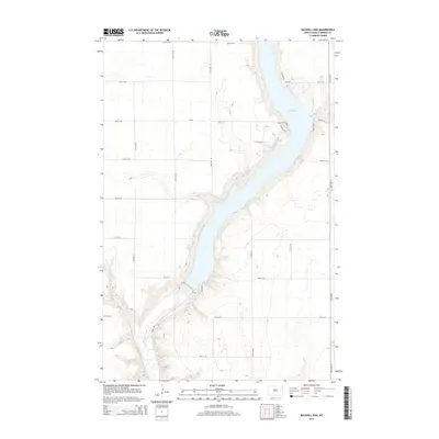
2014 Map of Baldhill Dam
USGS Topo · Published 2014About this map
Lake Ashtabula dominates this section of the Sheyenne River valley, where the reservoir's fingers reach into the surrounding prairie coulees. The landscape is defined by the contrast between the high, flat agricultural lands and the steep, wooded breaks leading down to the water's edge. Local access to the reservoir is concentrated at several key points along the eastern shore, including Katie Olson Lndg, Sadeks Lndg, and Eggerts Lndg. These landings represent the primary points of human activity in an otherwise rural grid of section roads. The map reveals the precise layout of River Rd and Cr-19, which navigate the elevation changes near the dam, providing a detailed look at the infrastructure supporting North Dakota's water management and recreation in the early twenty-first century.
Find a feature on this map
22 named features on this map. Tap any name to fly to it.
Don’t see what you’re looking for? This feature index may not catch every label — zoom into the map to look around manually.
Map Details
Editions of this 2014 Baldhill Dam Map
This is the sole edition of this map. No revisions or reprints were ever made.
Other maps of this area

1897 · Tower
USGS Topo · 1:125,000

1897 · Eckelson
USGS Topo · 1:125,000

1952 · Grand Forks
USGS Topo · 1:250,000

1952 · New Rockford
USGS Topo · 1:250,000

1953 · Jamestown
USGS Topo · 1:250,000

1953 · Fargo
USGS Topo · 1:250,000

1956 · New Rockford
USGS Topo · 1:250,000

1956 · Fargo
USGS Topo · 1:250,000

1956 · Jamestown
USGS Topo · 1:250,000

1956 · Grand Forks
USGS Topo · 1:250,000