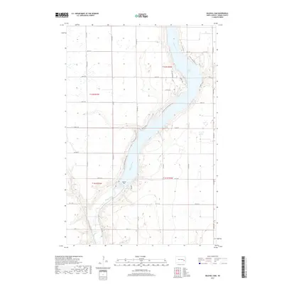
2017 Map of Baldhill Dam
USGS Topo · Published 2017About this map
Baldhill Dam anchors the landscape of Barnes County, where it impounds the Sheyenne River to create the expansive Lake Ashtabula. This 2017 survey details the recreational and residential development along the reservoir's winding shoreline, particularly on the eastern banks. Small residential clusters and landings, such as Lees Subdivision, Sadeks Lndg, and Eggert's Lndg, define the human footprint in this prairie river valley. On the western side of the water, the N Country National Scenic Trail follows the topography of the river bluffs, providing a continuous recreational corridor through the region. The map reflects the 21st-century character of the area, where water management and lakefront communities like Lake St Jenetts Beach and Martins Lndg have transformed the traditional agricultural sections of t142n r59w and t141n r58w.
Find a feature on this map
33 named features on this map. Tap any name to fly to it.
Don’t see what you’re looking for? This feature index may not catch every label — zoom into the map to look around manually.
Map Details
Editions of this 2017 Baldhill Dam Map
This is the sole edition of this map. No revisions or reprints were ever made.
Other maps of this area

1897 · Tower
USGS Topo · 1:125,000

1897 · Eckelson
USGS Topo · 1:125,000

1952 · Grand Forks
USGS Topo · 1:250,000

1952 · New Rockford
USGS Topo · 1:250,000

1953 · Jamestown
USGS Topo · 1:250,000

1953 · Fargo
USGS Topo · 1:250,000

1956 · New Rockford
USGS Topo · 1:250,000

1956 · Fargo
USGS Topo · 1:250,000

1956 · Jamestown
USGS Topo · 1:250,000

1956 · Grand Forks
USGS Topo · 1:250,000