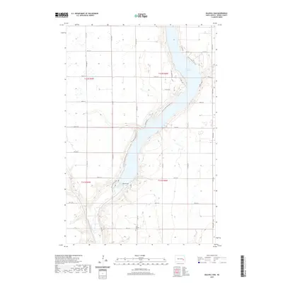
2020 Map of Baldhill Dam
USGS Topo · Published 2020About this map
Lake Ashtabula dominates this Barnes County landscape, created by the impoundment of the Sheyenne River at the Baldhill Dam. This 2020 survey illustrates the recreational and residential character that has developed along the reservoir's shoreline, specifically through several named landings and developments such as Lees Subdivision, Saders Lndg, and Eggert's Lndg. These small clusters of settlement contrast with the surrounding agricultural sections of t142n r58w and t141n r58w. For those interested in local heritage, the Zion Getchell Cem remains a fixed point of history amidst the changing land use. The map also traces the modern path of the N Country National Scenic Trail as it winds along the western banks, providing a detailed record of how public recreation and private residence coexist around this vital North Dakota waterway.
Find a feature on this map
33 named features on this map. Tap any name to fly to it.
Don’t see what you’re looking for? This feature index may not catch every label — zoom into the map to look around manually.
Map Details
Editions of this 2020 Baldhill Dam Map
This is the sole edition of this map. No revisions or reprints were ever made.
Other maps of this area

1897 · Tower
USGS Topo · 1:125,000

1897 · Eckelson
USGS Topo · 1:125,000

1952 · Grand Forks
USGS Topo · 1:250,000

1952 · New Rockford
USGS Topo · 1:250,000

1953 · Jamestown
USGS Topo · 1:250,000

1953 · Fargo
USGS Topo · 1:250,000

1956 · New Rockford
USGS Topo · 1:250,000

1956 · Fargo
USGS Topo · 1:250,000

1956 · Jamestown
USGS Topo · 1:250,000

1956 · Grand Forks
USGS Topo · 1:250,000