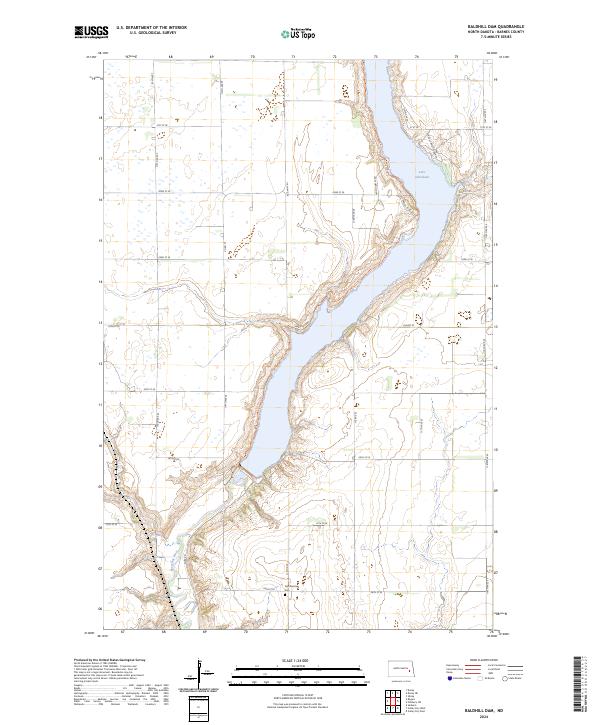
2024 Map of Baldhill Dam
USGS Topo · Published 2024About this map
Lake Ashtabula dominates the landscape of this Barnes County region, formed by the damming of the Sheyenne River. The reservoir's eastern and western shores are dotted with small residential clusters and recreational access points such as Lees Subdivision, Saders Lndg, and Eggerts Lndg. This modern survey reveals a highly managed environment where water conservation and recreation intersect, highlighted by the Baldhill Dam National Fish Hatchery located just south of the main impoundment.
Find a feature on this map
25 named features on this map. Tap any name to fly to it.
Don’t see what you’re looking for? This feature index may not catch every label — zoom into the map to look around manually.
Map Details
Editions of this 2024 Baldhill Dam Map
This is the sole edition of this map. No revisions or reprints were ever made.
Other maps of this area

1897 · Tower
USGS Topo · 1:125,000

1897 · Eckelson
USGS Topo · 1:125,000

1952 · Grand Forks
USGS Topo · 1:250,000

1952 · New Rockford
USGS Topo · 1:250,000

1953 · Jamestown
USGS Topo · 1:250,000

1953 · Fargo
USGS Topo · 1:250,000

1956 · New Rockford
USGS Topo · 1:250,000

1956 · Fargo
USGS Topo · 1:250,000

1956 · Jamestown
USGS Topo · 1:250,000

1956 · Grand Forks
USGS Topo · 1:250,000