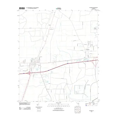
2012 Map of Baldwin
USGS Topo · Published 2012About this map
Whitehouse Naval Outlying Field and the sprawling extent of the Cecil Field Naval Air Sta dominate this part of the Florida landscape west of Jacksonville. The map illustrates a region transitioning from rural wooded areas to military and suburban expansion, anchored by small settlements like Otis, Mandeville, and Tulane. Several watercourses, including Brandy Br, McGirts Creek, and Yellow Water Cr, drain the low-lying terrain, creating a network of natural boundaries alongside major transportation corridors. Significant arterial routes such as Old Plank Rd and Dillon Rd bisect the area, providing a framework for local development. This 2012 survey captures the spatial relationship between these established military installations and the grid of residential streets, such as Lafayette St and Martin Luther King Jr Dr, that define the local community structure in the early 21st century.
Find a feature on this map
60 named features on this map. Tap any name to fly to it.
Don’t see what you’re looking for? This feature index may not catch every label — zoom into the map to look around manually.
Map Details
Editions of this 2012 Baldwin Map
This is the sole edition of this map. No revisions or reprints were ever made.
Other maps of this area

1917 · Cambon
USGS Topo · 1:62,500

1917 · Macclenny
USGS Topo · 1:62,500

1918 · Middleburg
USGS Topo · 1:62,500

1918 · Lawtey
USGS Topo · 1:62,500

1918 · Cambon
USGS Topo · 1:62,500

1918 · Macclenny
USGS Topo · 1:62,500

1941 · Middleburg
USGS Topo · 1:62,500

1948 · Jacksonville
USGS Topo · 1:250,000

1949 · Fiftone
USGS Topo · 1:24,000

1949 · Jacksonville Heights
USGS Topo · 1:24,000