
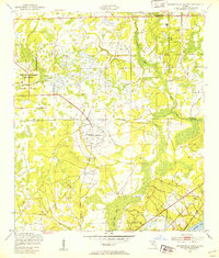
1949 Map of Jacksonville Heights
USGS Topo · Published 1953About this map
Military aviation infrastructure dominates the northern Florida landscape in the years following World War II, as seen in the expansive Reservation Boundary of the Cecil Naval Auxiliary Air Station. To the south, the distinctive circular runway pattern of Branan Outlying Air Field reflects the tactical training requirements of the era. The terrain is defined by low-lying wetlands and complex drainage systems, with Sal Taylor Creek and Ortega Creek winding through the sandy flats toward Doctors Lake. Small rural clusters like Jacksonville Heights and Federal Hill are connected by a network of unimproved roads and the Atlantic Coast Line railroad. This map captures a moment of transition where traditional piney-woods settlements were increasingly integrated into the growing defense footprint of the Jacksonville region.
Find a feature on this map
16 named features on this map. Tap any name to fly to it.
Don’t see what you’re looking for? This feature index may not catch every label — zoom into the map to look around manually.
Map Details
Editions of this 1949 Jacksonville Heights Map
2 editions found
Other maps of this area

1917 · Orange Park
USGS Topo · 1:62,500

1917 · Cambon
USGS Topo · 1:62,500

1918 · Middleburg
USGS Topo · 1:62,500

1918 · Cambon
USGS Topo · 1:62,500

1918 · Jacksonville
USGS Topo · 1:62,500

1918 · Orange Park
USGS Topo · 1:62,500

1941 · Middleburg
USGS Topo · 1:62,500

1948 · Jacksonville
USGS Topo · 1:250,000

1949 · Middleburg SW
USGS Topo · 1:24,000

1949 · Fiftone
USGS Topo · 1:24,000
Featured Places
- Jacksonville, FL
- Oak Hill, Jacksonville
- Westwood, Jacksonville
- Oak Hill Park, Jacksonville
- Ridgewood, FL