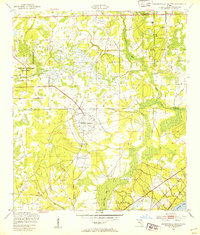
1949 Map of Jacksonville Heights
USGS Topo · Published 1953About this map
Military aviation infrastructure dominates this 1949 landscape at the boundary of Duval and Clay counties. The expansive Cecil Naval Auxiliary Air Station and the distinctive radial layout of Branan Outlying Air Field signify the strategic importance of this region in the post-war era. These facilities are set against a backdrop of low-lying wetlands and winding drainage systems including Ortega Creek, Yellow Water Creek, and Sal Taylor Creek, illustrating the complex task of carving out modern runways from the native Florida terrain.
Find a feature on this map
14 named features on this map. Tap any name to fly to it.
Don’t see what you’re looking for? This feature index may not catch every label — zoom into the map to look around manually.
Map Details
Editions of this 1949 Jacksonville Heights Map
2 editions found

Other maps of this area

1917 · Orange Park
USGS Topo · 1:62,500

1917 · Cambon
USGS Topo · 1:62,500

1918 · Middleburg
USGS Topo · 1:62,500

1918 · Cambon
USGS Topo · 1:62,500

1918 · Jacksonville
USGS Topo · 1:62,500

1918 · Orange Park
USGS Topo · 1:62,500

1941 · Middleburg
USGS Topo · 1:62,500

1948 · Jacksonville
USGS Topo · 1:250,000

1949 · Middleburg SW
USGS Topo · 1:24,000

1949 · Fiftone
USGS Topo · 1:24,000
Featured Places
- Jacksonville, FL
- Oak Hill, Jacksonville
- Westwood, Jacksonville
- Oak Hill Park, Jacksonville
- Ridgewood, FL