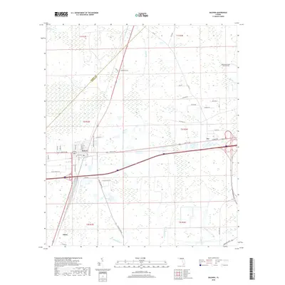
2018 Map of Baldwin
USGS Topo · Published 2018About this map
Baldwin stands at a crossroads of commerce and natural transition on the western edge of Duval County. This 2018 survey documents a landscape where modern transportation infrastructure bisects sensitive wetlands like Brandy Branch Swamp and the dense vegetation of Baldwin Bay. The western portion of the map follows the winding courses of Yellow Water Cr and Brandy Br, while the eastern portion is dominated by the sprawling grounds of the Whitehouse Naval Outlying Field. The settlement of Otis and the locality of Fiftone anchor smaller residential and rural pockets connected by a grid of named roads such as Old Plank Rd and Brandy Branch Rd. This edition reflects a decade of change in the suburban-rural interface, showing how water bodies like McGirts Cr and Caldwell Br influence the region's development patterns.
Find a feature on this map
57 named features on this map. Tap any name to fly to it.
Don’t see what you’re looking for? This feature index may not catch every label — zoom into the map to look around manually.
Map Details
Editions of this 2018 Baldwin Map
This is the sole edition of this map. No revisions or reprints were ever made.
Other maps of this area

1917 · Cambon
USGS Topo · 1:62,500

1917 · Macclenny
USGS Topo · 1:62,500

1918 · Middleburg
USGS Topo · 1:62,500

1918 · Lawtey
USGS Topo · 1:62,500

1918 · Cambon
USGS Topo · 1:62,500

1918 · Macclenny
USGS Topo · 1:62,500

1941 · Middleburg
USGS Topo · 1:62,500

1948 · Jacksonville
USGS Topo · 1:250,000

1949 · Fiftone
USGS Topo · 1:24,000

1949 · Jacksonville Heights
USGS Topo · 1:24,000