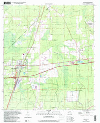
1998 Map of Baldwin
USGS Topo · Published 2001About this map
Baldwin serves as the central hub of this late-century landscape, positioned where major rail lines and roads converge near the boundary of Nassau and Duval Counties. The settlement pattern reveals the intersection of transportation and military history, with the town core featuring a High Sch and residential blocks surrounded by extensive timberlands and wetlands like Baldwin Bay. Industrial and communication infrastructure is prominent throughout the quadrangle, evidenced by multiple substations and the Radio Towers (WAPE) rising above the flatwoods.
Find a feature on this map
20 named features on this map. Tap any name to fly to it.
Don’t see what you’re looking for? This feature index may not catch every label — zoom into the map to look around manually.
Map Details
Editions of this 1998 Baldwin Map
This is the sole edition of this map. No revisions or reprints were ever made.
Other maps of this area

1917 · Cambon
USGS Topo · 1:62,500

1917 · Macclenny
USGS Topo · 1:62,500

1918 · Middleburg
USGS Topo · 1:62,500

1918 · Lawtey
USGS Topo · 1:62,500

1918 · Cambon
USGS Topo · 1:62,500

1918 · Macclenny
USGS Topo · 1:62,500

1941 · Middleburg
USGS Topo · 1:62,500

1948 · Jacksonville
USGS Topo · 1:250,000

1949 · Fiftone
USGS Topo · 1:24,000

1949 · Jacksonville Heights
USGS Topo · 1:24,000