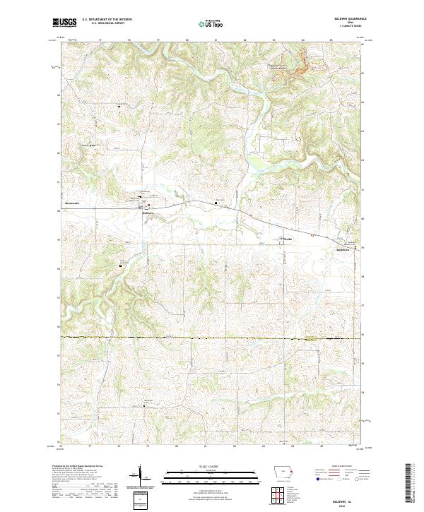
2022 Map of Baldwin
USGS Topo · Published 2022About this map
Maquoketa Caves Natural Bridge serves as a prominent geologic landmark in this Jackson County landscape, where the Maquoketa River and its many tributaries, including Raccoon Cr and Bear Cr, have carved deep into the terrain. The settlement of Baldwin sits at the heart of a region defined by agricultural traditions and long-standing community sites. For family historians, the area is notably dense with small burial grounds, ranging from church-affiliated sites like Holy Trinity Catholic Cem to family plots such as Foley Farm Cem and Reel Cem. To the east, the small communities of Nashville and Buckhorn are connected by a network of local roads and sections, including Co HWY y34. The northern reaches include a series of dedicated trails like the Outer Loop Trl and Woodland Walk Trl, reflecting the area's preservation of its natural topography alongside established settlements like Monmouth.
Find a feature on this map
76 named features on this map. Tap any name to fly to it.
Don’t see what you’re looking for? This feature index may not catch every label — zoom into the map to look around manually.
Map Details
Editions of this 2022 Baldwin Map
This is the sole edition of this map. No revisions or reprints were ever made.
Other maps of this area

1891 · DeWitt
USGS Topo · 1:62,500

1891 · Maquoketa
USGS Topo · 1:62,500

1891 · Baldwin
USGS Topo · 1:62,500

1892 · Wheatland
USGS Topo · 1:62,500

1894 · Wheatland
USGS Topo · 1:62,500

1901 · Peosta
USGS Topo · 1:125,000

1901 · Rock Island
USGS Topo · 1:125,000

1910 · Rock Island
USGS Topo · 1:125,000

1958 · Davenport
USGS Topo · 1:250,000

1959 · Dubuque
USGS Topo · 1:250,000