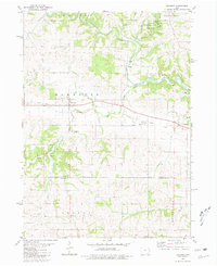
1980 Map of Baldwin
USGS Topo · Published 1981About this map
Maquoketa Caves State Park anchors the northern portion of this landscape, where the Maquoketa River and Raccoon Creek cut through the terrain to reveal a Natural Bridge and numerous Caves. The area reflects a transition from early industrial extraction to conservation, evidenced by the presence of several Quarries and a Sandpit alongside the Eden Valley County Refuge. Settled nodes like Baldwin and Nashville are connected by an Old Railroad Grade, tracing a corridor of former transport that once linked these rural communities.
Find a feature on this map
36 named features on this map. Tap any name to fly to it.
Don’t see what you’re looking for? This feature index may not catch every label — zoom into the map to look around manually.
Map Details
Editions of this 1980 Baldwin Map
This is the sole edition of this map. No revisions or reprints were ever made.
Other maps of this area

1891 · DeWitt
USGS Topo · 1:62,500

1891 · Maquoketa
USGS Topo · 1:62,500

1891 · Baldwin
USGS Topo · 1:62,500

1892 · Wheatland
USGS Topo · 1:62,500

1894 · Wheatland
USGS Topo · 1:62,500

1901 · Peosta
USGS Topo · 1:125,000

1901 · Rock Island
USGS Topo · 1:125,000

1910 · Rock Island
USGS Topo · 1:125,000

1958 · Davenport
USGS Topo · 1:250,000

1959 · Dubuque
USGS Topo · 1:250,000