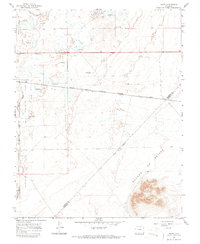
1965 Map of Baldy
USGS Topo · Published 1987About this map
The Alamosa National Wildlife Refuge occupies the western edge of this 1965 survey, marking a protected landscape where the San Luis Valley floor meets the base of the mountains. This area is defined by the high-altitude hydrology of the Rio Grande basin, evidenced by the numerous Flowing Wells scattered across the plains. The southern portion of the map is dominated by the Sangre De Cristo Grant Boundary, a significant historical land line cutting diagonally across the terrain near the Alamosa and Costilla County line.
Find a feature on this map
12 named features on this map. Tap any name to fly to it.
Don’t see what you’re looking for? This feature index may not catch every label — zoom into the map to look around manually.
Map Details
Editions of this 1965 Baldy Map
2 editions found
Other maps of this area

1954 · Trinidad
USGS Topo · 1:250,000

1955 · Trinidad
USGS Topo · 1:250,000

1958 · Trinidad
USGS Topo · 1:250,000

1959 · Trinidad
USGS Topo · 1:250,000

1965 · Blanca
USGS Topo · 1:24,000

1965 · Baldy
USGS Topo · 1:24,000

1965 · Lasauses
USGS Topo · 1:24,000

1965 · Blanca SE
USGS Topo · 1:24,000

1965 · Dry Lakes
USGS Topo · 1:24,000

1965 · Twin Peaks
USGS Topo · 1:24,000