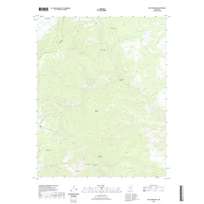
2020 Map of Baldy Mountain
USGS Topo · Published 2020About this map
Baldy Mtn anchors the southern boundary of this high-elevation terrain within the Cimarron Range, where the borders of Taos Co and Colfax Co meet. The landscape is defined by its drainage systems and steep ridgelines, notably French Henry Ridge and Aztec Ridge, which converge near Copper Park. The northern reaches include the expansive Valle Vidal and the prominent geological formation known as The Rock Wall, overlooking the descent into Seally Canyon.
Find a feature on this map
22 named features on this map. Tap any name to fly to it.
Don’t see what you’re looking for? This feature index may not catch every label — zoom into the map to look around manually.
Map Details
Editions of this 2020 Baldy Mountain Map
This is the sole edition of this map. No revisions or reprints were ever made.
Other maps of this area

1954 · Raton
USGS Topo · 1:250,000

1955 · Ute Park
USGS Topo · 1:62,500

1958 · Raton
USGS Topo · 1:250,000

1962 · Ash Mountain
USGS Topo · 1:62,500

1963 · Eagle Nest
USGS Topo · 1:24,000

1963 · Red River Pass
USGS Topo · 1:24,000

1963 · Comanche Point
USGS Topo · 1:24,000

1982 · Wheeler Peak
USGS Topo · 1:100,000
1986 · Van Bremmer Park
USGS Topo · 1:24,000
1986 · Ash Mountain
USGS Topo · 1:24,000