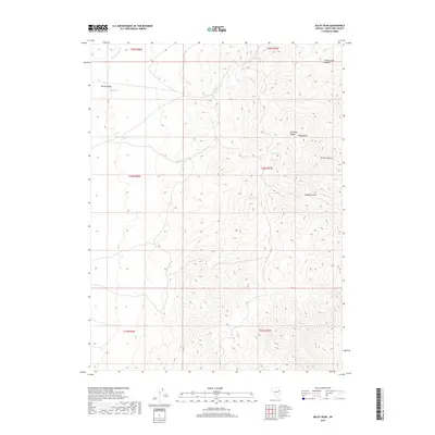
2018 Map of Baldy Peak
USGS Topo · Published 2018About this map
Baldy Peak rises as the dominant landmark of the Antelope Range in this high-altitude landscape of eastern Nevada. The terrain is defined by a series of steep drainages, including Cottonwood Canyon and Secret Canyon, which descend toward the broad expanse of Spring Valley. Water is a critical and concentrated resource in this environment, as evidenced by a network of vital watering points such as Middle Creek Spring, Grassy Spring, North Spring, and Lost Spring. These scattered springs and seasonal drainages like Spring Valley Cr and Sharp Cr have historically dictated the movement of livestock and wildlife across this section of White Pine County. The map provides a precise view of the topography before significant modern development, showing the complex ridges and canyons that separate the high peaks from the valley floor.
Find a feature on this map
21 named features on this map. Tap any name to fly to it.
Don’t see what you’re looking for? This feature index may not catch every label — zoom into the map to look around manually.
Map Details
Editions of this 2018 Baldy Peak Map
This is the sole edition of this map. No revisions or reprints were ever made.
Other maps of this area

1955 · Elko
USGS Topo · 1:250,000

1956 · Ely
USGS Topo · 1:250,000

1958 · Elko
USGS Topo · 1:250,000

1959 · Ely
USGS Topo · 1:250,000

1962 · Elko
USGS Topo · 1:250,000

1963 · Ely
USGS Topo · 1:250,000

1965 · Elko
USGS Topo · 1:250,000

1979 · Sunset Reservoir
USGS Topo · 1:24,000

1982 · Chin Creek Spring
USGS Topo · 1:24,000
1982 · Becky Peak
USGS Topo · 1:24,000