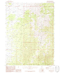
1986 Map of Baldy Peak
USGS Topo · Published 1986About this map
The Antelope Range dominates this mid-1980s landscape in White Pine County, rising to its topographical high point at Baldy Peak. The eastern slopes are characterized by a series of deep drainage systems, including Cottonwood Canyon, Secret Canyon, and Tunnel Canyon, while the western side is defined by the headwaters of the Spring Valley Creek system. This map captures a classic Great Basin environment where water resources are scarce, marked by isolated springs that supported the region's ranching and prospecting history. The complex network of ephemeral waterways like Middle Creek and Sharp Creek illustrates the seasonal flow patterns that shaped local land use and transit routes across the range during the late twentieth century.
Find a feature on this map
10 named features on this map. Tap any name to fly to it.
Don’t see what you’re looking for? This feature index may not catch every label — zoom into the map to look around manually.
Map Details
Editions of this 1986 Baldy Peak Map
This is the sole edition of this map. No revisions or reprints were ever made.
Other maps of this area

1955 · Elko
USGS Topo · 1:250,000

1956 · Ely
USGS Topo · 1:250,000

1958 · Elko
USGS Topo · 1:250,000

1959 · Ely
USGS Topo · 1:250,000

1962 · Elko
USGS Topo · 1:250,000

1963 · Ely
USGS Topo · 1:250,000

1965 · Elko
USGS Topo · 1:250,000

1979 · Sunset Reservoir
USGS Topo · 1:24,000

1982 · Chin Creek Spring
USGS Topo · 1:24,000
1982 · Becky Peak
USGS Topo · 1:24,000