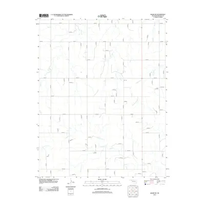
2012 Map of Balko NE
USGS Topo · Published 2012About this map
The High Plains of Beaver County are defined by a rhythmic grid of rural section roads and the drainage patterns of the North Canadian River watershed. Watercourses like Sixmile Cr and Cottonwood Cr carve subtle relief into the landscape, dictating the placement of early 21st-century infrastructure and land boundaries. The map reveals the placement of essential community anchors, including Busch Chapel Cem and Capitol View Cem, which provide critical reference points for genealogical research in this part of the Oklahoma Panhandle.
Find a feature on this map
63 named features on this map. Tap any name to fly to it.
Don’t see what you’re looking for? This feature index may not catch every label — zoom into the map to look around manually.
Map Details
Editions of this 2012 Balko NE Map
This is the sole edition of this map. No revisions or reprints were ever made.
Other maps of this area

1954 · Perryton
USGS Topo · 1:250,000

1958 · Perryton
USGS Topo · 1:250,000

1971 · Clear Lake NW
USGS Topo · 1:24,000

1971 · Clear Lake SW
USGS Topo · 1:24,000
1971 · Mocane SW
USGS Topo · 1:24,000

1973 · Balko
USGS Topo · 1:24,000

1973 · Balko NE
USGS Topo · 1:24,000

1973 · Elmwood
USGS Topo · 1:24,000

1973 · Floris
USGS Topo · 1:24,000

1973 · Beaver
USGS Topo · 1:24,000