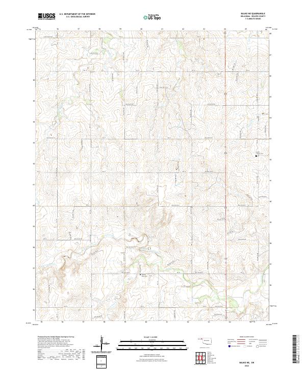
2022 Map of Balko NE
USGS Topo · Published 2022About this map
North Fork Clear Creek and its various tributaries, including the North Fork Clear Creek and S Fork Clear Cr, dominate the drainage patterns of this corner of the Oklahoma Panhandle. This landscape in Beaver County is defined by a grid-like network of rural roads that partition the high plains, punctuated by small community anchors and burial grounds. Genealogists will find the locations of Busch Chapel Cem in the eastern portion of the survey and Capitol View Cem further south, providing specific coordinates for local family histories. Other watercourses like Sixmile Cr, Home Cr, and Cottonwood Cr carve subtle variations into the terrain, illustrating the hydrologic system that supports the agricultural life of this semi-arid region.
Find a feature on this map
54 named features on this map. Tap any name to fly to it.
Don’t see what you’re looking for? This feature index may not catch every label — zoom into the map to look around manually.
Map Details
Editions of this 2022 Balko NE Map
This is the sole edition of this map. No revisions or reprints were ever made.
Other maps of this area

1954 · Perryton
USGS Topo · 1:250,000

1958 · Perryton
USGS Topo · 1:250,000

1971 · Clear Lake NW
USGS Topo · 1:24,000

1971 · Clear Lake SW
USGS Topo · 1:24,000
1971 · Mocane SW
USGS Topo · 1:24,000

1973 · Balko
USGS Topo · 1:24,000

1973 · Balko NE
USGS Topo · 1:24,000

1973 · Elmwood
USGS Topo · 1:24,000

1973 · Floris
USGS Topo · 1:24,000

1973 · Beaver
USGS Topo · 1:24,000