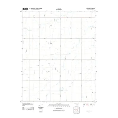
2012 Map of Balko SW
USGS Topo · Published 2012About this map
Blue Mound Cem sits as a lonely landmark within the sprawling grid of section roads that define this portion of the Oklahoma Panhandle in the early 21st century. The landscape is characterized by the meandering drainages of N Fork Clear Cr and S Fork Clear Cr, which cut subtle, irregular paths through a terrain otherwise strictly organized by a dense network of local roads such as N1300 Rd and E0300 Rd. This map reveals a late-stage agricultural pattern where the natural hydrology of the Clear Creek forks dictates the only breaks in a relentless geometric survey. The presence of the cemetery suggests a history of rural settlement where small community centers have faded, leaving only family burial grounds and a labyrinth of rural routes to mark the former homesteads of Beaver County.
Find a feature on this map
48 named features on this map. Tap any name to fly to it.
Don’t see what you’re looking for? This feature index may not catch every label — zoom into the map to look around manually.
Map Details
Editions of this 2012 Balko SW Map
This is the sole edition of this map. No revisions or reprints were ever made.
Other maps of this area

1954 · Perryton
USGS Topo · 1:250,000

1958 · Perryton
USGS Topo · 1:250,000

1973 · Booker
USGS Topo · 1:24,000

1973 · Balko
USGS Topo · 1:24,000

1973 · Boyd
USGS Topo · 1:24,000

1973 · Balko NE
USGS Topo · 1:24,000

1973 · Perryton
USGS Topo · 1:24,000

1973 · Elmwood
USGS Topo · 1:24,000

1973 · Bryans Corner
USGS Topo · 1:24,000

1973 · Balko SW
USGS Topo · 1:24,000