
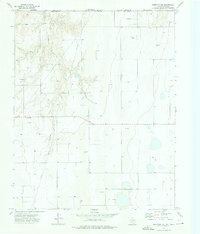
1973 Map of Perryton
USGS Topo · Published 1976About this map
Perryton sits at the northern edge of the Texas Panhandle, just below the state line where Beaver and Ochiltree counties meet. In the early 1970s, the town functioned as a critical regional hub, defined by the diagonal transit of the Atchison Topeka and Santa Fe railroad and the intersection of Highway 83 and Highway 15. The landscape reflects a dual economy of agriculture and energy, dotted with numerous oil and gas wells across the high plains. Within the city grid, residential life is anchored by Central Jr High Sch and High Sch, while local leisure is evidenced by Leatherman Park, Stark Park, and a Drive-in Theater on the eastern outskirts. The periphery includes the Perryton Municipal Airport and a series of Sewage Disposal Ponds, marking the town's mid-century infrastructure and growth.
Find a feature on this map
32 named features on this map. Tap any name to fly to it.
Don’t see what you’re looking for? This feature index may not catch every label — zoom into the map to look around manually.
Map Details
Editions of this 1973 Perryton Map
This is the sole edition of this map. No revisions or reprints were ever made.
Other maps of this area

1954 · Perryton
USGS Topo · 1:250,000

1958 · Perryton
USGS Topo · 1:250,000

1973 · Farnsworth
USGS Topo · 1:24,000

1973 · Booker SW
USGS Topo · 1:24,000

1973 · Perryton SE
USGS Topo · 1:24,000

1973 · Bryans Corner SW
USGS Topo · 1:24,000

1973 · Bryans Corner
USGS Topo · 1:24,000

1973 · Balko SW
USGS Topo · 1:24,000

1973 · Huntoon
USGS Topo · 1:24,000
1973 · Perryton NW
USGS Topo · 1:24,000