
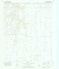
1973 Map of Farnsworth
USGS Topo · Published 1975About this map
Farnsworth and the small siding of Lord anchor this 1970s landscape in the Texas Panhandle, defined by the industrial footprint of the High Plains energy and transit economy. The Atchison Topeka and Santa Fe railroad cuts a diagonal line across the terrain, running parallel to a major Pipeline that serves the numerous Oil Wells and Gas Wells scattered throughout the quadrangle. This period of the 1970s shows the region's heavy reliance on fossil fuel extraction, with infrastructure reaching into every corner of the grid.
Find a feature on this map
13 named features on this map. Tap any name to fly to it.
Don’t see what you’re looking for? This feature index may not catch every label — zoom into the map to look around manually.
Map Details
Editions of this 1973 Farnsworth Map
This is the sole edition of this map. No revisions or reprints were ever made.
Other maps of this area

1954 · Perryton
USGS Topo · 1:250,000

1958 · Perryton
USGS Topo · 1:250,000

1973 · Horseshoe Hill
USGS Topo · 1:24,000

1973 · Sourdough Creek NE
USGS Topo · 1:24,000

1973 · Perryton SE
USGS Topo · 1:24,000

1973 · Perryton
USGS Topo · 1:24,000

1973 · Waka
USGS Topo · 1:24,000

1973 · Spearman NE
USGS Topo · 1:24,000

1973 · Sourdough Creek NW
USGS Topo · 1:24,000
1973 · Perryton NW
USGS Topo · 1:24,000