
1973 Map of Sourdough Creek NW
USGS Topo · Published 1976About this map
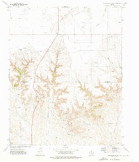
Middle Prong Wolf Creek meanders through the northeast corner of this 1973 survey, a prominent watercourse in an otherwise arid expanse of Ochiltree County. The landscape is defined almost entirely by mid-century energy production, dominated by a sprawling Oil and Gas Field that stretches across the plains. This industrial footprint is visible through a dense network of Pipelines and numerous Oil Wells, reflecting the region's intensive resource extraction during the 1970s. Grounded infrastructure, such as the Landing Strip and multiple instances of a Pumping Sta, suggests a remote operational environment where aviation and specialized machinery were essential for maintenance and logistics. Aside from these industrial markers, the terrain remains largely open, with contour lines indicating the subtle topography typical of the Texas Panhandle.
Find a feature on this map
9 named features on this map. Tap any name to fly to it.
Don’t see what you’re looking for? This feature index may not catch every label — zoom into the map to look around manually.
Map Details
Editions of this 1973 Sourdough Creek NW Map
This is the sole edition of this map. No revisions or reprints were ever made.
Other maps of this area

1954 · Perryton
USGS Topo · 1:250,000

1958 · Perryton
USGS Topo · 1:250,000

1973 · Farnsworth
USGS Topo · 1:24,000

1973 · Sourdough Creek NE
USGS Topo · 1:24,000

1973 · Perryton SE
USGS Topo · 1:24,000

1973 · Waka
USGS Topo · 1:24,000

1973 · Sourdough Creek SW
USGS Topo · 1:24,000

1973 · Spearman NE
USGS Topo · 1:24,000

1973 · Spearman SE
USGS Topo · 1:24,000
1973 · Sourdough Creek
USGS Topo · 1:24,000