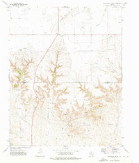
1973 Map of Sourdough Creek
USGS Topo · Published 1976About this map
The Oil and Gas Field dominates this High Plains landscape along the boundary of Ochiltree and Roberts Counties. In the early 1970s, this area was defined by a dense network of energy infrastructure, where numerous gas wells and pipelines intersected the natural drainages of Sourdough Creek and South Wolf Creek. The map reveals the industrial character of the era, showing technical features like a Pumping Sta, Storage Bins, and a Drill Hole. Aviation support for this remote energy sector is evident via the McLain Airport and Harbaugh Airport. While much of the terrain is marked by industrial utility, the inclusion of a Roadside Park suggests a point of rest for travelers moving through this intensive production zone. Local history researchers will find a detailed record of land use before modern technological shifts altered the footprint of the Texas Panhandle's energy fields.
Find a feature on this map
15 named features on this map. Tap any name to fly to it.
Don’t see what you’re looking for? This feature index may not catch every label — zoom into the map to look around manually.
Map Details
Editions of this 1973 Sourdough Creek Map
This is the sole edition of this map. No revisions or reprints were ever made.
Other maps of this area

1954 · Perryton
USGS Topo · 1:250,000

1954 · Amarillo
USGS Topo · 1:250,000

1958 · Perryton
USGS Topo · 1:250,000

1958 · Amarillo
USGS Topo · 1:250,000

1971 · Dry Creek NE
USGS Topo · 1:24,000

1971 · Dry Creek North
USGS Topo · 1:24,000

1972 · Horse Creek North
USGS Topo · 1:24,000

1973 · Sourdough Creek NE
USGS Topo · 1:24,000

1973 · Pickett Ranch Creek
USGS Topo · 1:24,000

1973 · Lake Fryer
USGS Topo · 1:24,000