
1972 Map of Horse Creek North
USGS Topo · Published 1974About this map
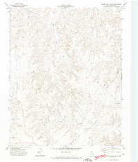
The Canadian River carves a broad valley through the Roberts County landscape, creating a distinct topographical boundary between the northern plateaus and the dissected canyonlands to the south. In this early 1970s survey, the territory is defined by its drainage network and energy extraction. Numerous Oil Wells, Gas Wells, and Drill Holes are scattered across the terrain, particularly near the river and along the higher elevations of Point Creek. The presence of a prominent Pipeline and a Gravel Pit in the southwest corner suggests an active industrial landscape focused on natural resource development. Moving south, the terrain becomes increasingly complex as Horse Creek and Three Corrals Creek cut deep into the earth. The lack of established towns highlights the area's character as a working rangeland, where a Jeep Trail provides one of the few passages through the eastern breaks near Home Ranch Creek.
Find a feature on this map
13 named features on this map. Tap any name to fly to it.
Don’t see what you’re looking for? This feature index may not catch every label — zoom into the map to look around manually.
Map Details
Editions of this 1972 Horse Creek North Map
This is the sole edition of this map. No revisions or reprints were ever made.
Other maps of this area

1954 · Perryton
USGS Topo · 1:250,000

1954 · Amarillo
USGS Topo · 1:250,000

1958 · Perryton
USGS Topo · 1:250,000

1958 · Amarillo
USGS Topo · 1:250,000

1971 · Dry Creek SE
USGS Topo · 1:24,000

1971 · Dry Creek NE
USGS Topo · 1:24,000

1972 · Washburn Arroyo
USGS Topo · 1:24,000

1972 · East Dry Creek
USGS Topo · 1:24,000
1972 · Horse Creek South
USGS Topo · 1:24,000

1973 · Pickett Ranch Creek
USGS Topo · 1:24,000